Maps of Cambridgeshire County England
Home > Maps of England > Cambridgeshire County Maps
Welcome to our Cambridgeshire County map page. The map of Cambridgeshire England that is located below is provided by Google Maps. You can "grab" the electronic map and move it around to re-center the map. You can change between standard map view and satellite map view by clicking the small square on the bottom left-hand corner of the map. Satellite map view utilises orbiting satellite and / or aerial high-resolution photography to display images of the map location to street level detail (really quite amazing). Standard map view shows a traditional street map (also known as a road map). You can use the zoom buttons on the bottom right-hand side of the map to zoom in or out to street level detail. We have digital online maps for most towns and cities on the Maps of England page. We also have a good collection of old school printable maps on the Maps of England page.
A map of Cambridgeshire County, England
I hope you like the Cambridgeshire County, England+ 2 End United Kingdom Maps
Cambridgeshire County Maps
Abington |
Alconbury |
Babraham |
Bar Hill |
Bassingbourn cum Kneesworth |
Benwick |
Bluntisham |
Bottisham
Bourn |
Buckden |
Burwell |
Cambourne |
Cambridge |
Chatteris |
Christchurch |
Comberton |
Coton |
Cottenham
Duxford |
Eaton Socon |
Eltisley |
Elton |
Ely |
Fenstanton |
Fordham |
Fowlmere |
Foxton |
Fulbourn |
Gamlingay
Girton |
Glinton |
Godmanchester |
Grafham |
Grantchester |
Great and Little Shelford |
Great, Little and Steeple Gidding
Great Raveley |
Guyhirn |
Haddenham |
Hardwick |
Harston |
Helpston |
Hemingford Grey |
Histon and Impington
Huntingdon |
Impington |
Kimbolton |
Kings Ripton |
Knapwell |
Landbeach |
Linton |
Little and Great Eversden
Little Downham |
Littleport |
March |
Melbourn |
Meldreth |
Milton |
Norman Cross |
Oakington |
Over |
Pampisford
Papworth Everard |
Peterborough |
Ramsey |
Sawston |
Sawtry |
Shepreth |
Snailwell |
Soham |
Somersham |
St Ives
St Neots |
Steeple Morden |
Stow-cum-Quy |
Swavesey |
Thriplow |
Toft |
Upwood and The Raveleys |
Warboys
Waterbeach |
West Perry |
Whittlesey |
Whittlesford |
Wicken |
Wilburton |
Willingham |
Wisbech |
Yaxley
Cambridgeshire County Map
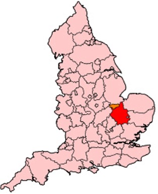
Cambridgeshire also known, archaically, as the County of Cambridge; abbreviated Cambs.) is a county in England. Modern Cambridgeshire was formed from the historic counties of Cambridgeshire and Huntingdonshire, together with the Isle of Ely and the Soke of Peterborough; it contains most of the region known as Silicon Fen. The county town is Cambridge.

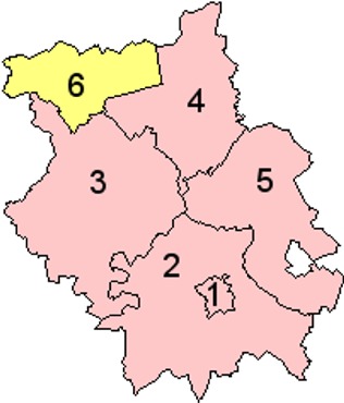
Districts of Cambridgeshire County

1. Cambridge
2. South Cambridgeshire
3. Huntingdonshire
4. Fenland
5. East Cambridgeshire
6. Peterborough
From Wikipedia, the free encyclopedia
Music


