Maps of Oxfordshire County England
Home > Maps of England > Oxfordshire County Maps
Welcome to our Oxfordshire County map page. The map of Oxfordshire England that is located below is provided by Google Maps. You can "grab" the electronic map and move it around to re-center the map. You can change between standard map view and satellite map view by clicking the small square on the bottom left-hand corner of the map. Satellite map view utilises orbiting satellite and / or aerial high-resolution photography to display images of the map location to street level detail (really quite amazing). Standard map view shows a traditional street map (also known as a road map). You can use the zoom buttons on the bottom right-hand side of the map to zoom in or out to street level detail. We have digital online maps for most towns and cities on the Maps of England page. We also have a good collection of old school printable maps on the Maps of England page.
I hope you like the Oxfordshire, England+ 2 End United Kingdom Maps
Oxfordshire County Maps
Abingdon |
Adderbury |
Ardington and Lockinge |
Ascott-under-Wychwood |
Bampton |
Banbury |
Benson |
Bicester
Blewbury |
Bloxham |
Bodicote |
Botley |
Brightwell-cum-Sotwell |
Burford |
Carterton |
Cassington |
Chadlington
Chalgrove |
Charlbury |
Checkendon |
Chesterton |
Childrey |
Chinnor |
Chipping Norton |
Cholsey |
Clanfield
Clifton Hampden |
Culham |
Deddington |
Didcot |
Dorchester |
Drayton |
East Hagbourne |
East Hendred
Enstone |
Eynsham |
Faringdon |
Fernham |
Frilford |
Fritwell |
Garsington |
Goring |
Great Milton |
Grove |
Harwell
Henley on Thames |
Holton |
Hook Norton |
Horspath |
Islip |
Kidlington |
Kingham |
Kingston Bagpuize with Southmoor
Kirtlington |
Long Hanborough |
Long Wittenham |
Longcot |
Longworth |
Middle Barton |
Milton |
Nettlebed
North Moreton |
Oxford |
Radley |
Rotherfield Peppard |
Sandford-on-Thames |
Shellingford |
Shipton-under-Wychwood
Shrivenham |
Sonning Common |
South Moreton |
Stanford in the Vale |
Steeple Aston |
Steventon |
Stratton Audley
Sunningwell |
Sutton Courtenay |
Thame |
Uffington |
Wallingford |
Wantage |
Watchfield |
Watlington
Weston-on-the-Green |
Wheatley |
Whitchurch-on-Thames |
Witney |
Woodcote |
Woodstock |
Wootton |
Wytham
Oxfordshire County Map
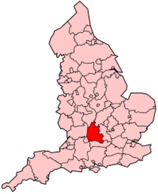
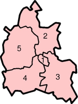
Oxfordshire is a county in the South East England region. It is divided into five local government districts: Oxford, Cherwell, Vale of White Horse (after the Uffington White Horse), West Oxfordshire and South Oxfordshire.
The county has a major tourism industry. The area is noted for the concentration of performance motorsport companies and facilities. Oxford University Press has headed a concentration of print and publishing firms; the university is also linked to the concentration of local biotechnology companies.
The main centre of population is the city of Oxford. Other significant settlements are Banbury, Bicester, Kidlington, and Chipping Norton to the north of Oxford; Witney to the west; Thame and Chinnor to the east; and Abingdon, Wantage, Didcot, Wallingford and Henley-on-Thames to the south. Future population growth in the county is hoped to be concentrated around Oxford, Banbury, Bicester, Didcot and Witney, near the South Midlands growth area.
The highest point of the county is Whitehorse Hill, in the Vale of White Horse, reaching 856 feet (261m).
Oxfordshire's county flower is the Snake's-head Fritillary.

Districts of Oxfordshire County

1. Oxford
2. Cherwell
3. South Oxfordshire
4. Vale of White Horse
5. West Oxfordshire
Permission is granted to copy, distribute and/or modify this document under the terms of the GNU Free Documentation License, Version 1.2 or any later version published by the Free Software Foundation; with no Invariant Sections, no Front-Cover Texts, and no Back-Cover Texts. A copy of the license is included in the section entitled "GNU Free Documentation License".
From Wikipedia, the free encyclopedia
Music


